|
|
General
Feb 18, 2011 19:59:32 GMT -9
Post by grrraaahhh on Feb 18, 2011 19:59:32 GMT -9
General discussion thread on North American brown and grizzly bears.
|
|
|
|
General
Feb 18, 2011 20:07:15 GMT -9
Post by grrraaahhh on Feb 18, 2011 20:07:15 GMT -9
I messed up trying to move your post (the question was better suited in a different thread) but I was able to quote it: More on Goliath at a later date. |
|
|
|
General
Feb 20, 2011 7:31:31 GMT -9
Post by grrraaahhh on Feb 20, 2011 7:31:31 GMT -9
 Harbor seals are prey item for coastal brown bears, Troyer (2005). |
|
|
|
Post by grrraaahhh on Mar 8, 2011 7:02:25 GMT -9
How strong is a brown bear? The answer is difficult to quantify, however, renowned biologist Stephen Herrero stated the following:
A brown bear is capable of dragging off a full-grown moose. His strong legs and claws can move boulders and huge hunks of earth. A blow from his paws can break the neck of a moose or another bear.
Bear Attacks: Their Causes and Avoidance (1985).
|
|
|
|
General
May 7, 2011 20:31:49 GMT -9
Post by grrraaahhh on May 7, 2011 20:31:49 GMT -9
The Bush (Alaska)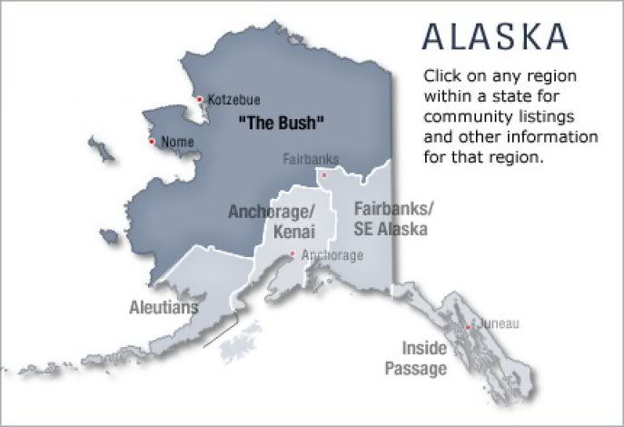 From wikipedia: The Bush is a term for the portions of Alaska that are not connected to North America's road network. The majority of Alaska's native populations live in the Bush, living off the land as their ancestors did. Places in the Bush include Bethel, Dillingham, King Salmon, Nome, Barrow, Katmai National Park, Kodiak Island, Kotzebue, and Unalaska-Dutch Harbor. Most parts of Alaska that are off the road system can only be reached by small airplane, and travel from place to place is typically accomplished by means of transportation such as snowmobile or snow machine, boat, or dog sled. en.wikipedia.org/wiki/The_Bush_%28Alaska%29
|
|
|
|
General
May 10, 2011 6:43:00 GMT -9
Post by grrraaahhh on May 10, 2011 6:43:00 GMT -9
ConservationTrans-Alaska Pipeline System The Trans-Alaska Pipeline System (TAPS), includes the Trans-Alaska Pipeline, 11 pump stations, several hundred miles of feeder pipelines, and the Valdez Marine Terminal. TAPS is one of the world's largest pipeline systems. It is commonly called the Alaska Pipeline, Trans-Alaska Pipeline, or Alyeska Pipeline, (or the Pipeline as referred to in Alaska), but those terms technically apply only to the 800 miles (1,287 km) of the pipeline with the diameter of 48 inches (122 cm) that conveys oil from Prudhoe Bay, to Valdez, Alaska. The crude oil pipeline is privately owned by the Alyeska Pipeline Service Company. The pipeline was built between 1974 and 1977 after the 1973 oil crisis caused a sharp rise in oil prices in the United States. This rise made exploration of the Prudhoe Bay oil field economically feasible. Environmental, legal, and political debates followed the discovery of oil at Prudhoe Bay in 1968, and the pipeline was built only after the oil crisis provoked the passage of legislation designed to remove legal challenges to the project. The task of building the pipeline had to address a wide range of difficulties, stemming mainly from the extreme cold and the difficult, isolated terrain. The construction of the pipeline was one of the first large-scale projects to deal with problems caused by permafrost, and special construction techniques had to be developed to cope with the frozen ground. The project attracted tens of thousands of workers to Alaska, causing a boomtown atmosphere in Valdez, Fairbanks, and Anchorage. The first barrel of oil traveled through the pipeline in 1977, and full-scale production began by the end of the year. Several notable incidents of oil leakage have occurred since, including those caused by sabotage, maintenance failures, and gunshot holes. The most significant oil spill associated with the pipeline was caused by the Exxon Valdez, and did not directly involve the pipeline. As of 2010, the pipeline has shipped almost 16 billion barrels (2.5×10⁹ m3) of oil. Source: en.wikipedia.org/wiki/Trans-Alaska_Pipeline_SystemBears and Pipeline Construction in AlaskaABSTRACT. Serious problems were encountered with bears during construction of the 1274-km-long trans-Alaska oil pipelinebetween Prudhoe Bay and Valdez. This multi-billion-dollar project traversed both black bear (Ursus americanus Pallas) and grizzly bear (U. arctos L.) habitat throughout its entire length. Plans for dealing with anticipated problems with bears were often inadequate. Most (71%) problems occurred north of the Yukon River in a previously roadless Wilderness where inadequate refuse disposal and widespread animal feeding created dangerous situations. Of the 192 officially reported bear problems associated with the Trans-Alaska Pipeline System (TAPS) (1971-79), about 65% involved the presence of bears in camps or dumps, 13% the feeding of bears on garbage or handouts, 10% property damage or economic loss, 7% bears under and in buildings, and only5% charges by bears. Remarkably, no bear-related injuries were reported, suggesting that bears became accustomed to people and did not regard them as a threat. Following construction f the TAPS there have been proposals for pipelines to transport natural gas from Prudhoe Bay to southern and Pacific-rim markets. Based on past experience, some animal control measures were developed during the planning phase for the authorized gas pipeline route in Alaska. Fences installed around 100-person "survey" camps were found to be effective in deterring bears in two traditionally troublesome areas. FREE PDF LINK: arctic.synergiesprairies.ca/arctic/index.php/arctic/article/download/1598/1577
|
|
|
|
General
Aug 12, 2011 11:09:57 GMT -9
Post by brotherbear on Aug 12, 2011 11:09:57 GMT -9
The most often asked question concerning grizzly bears: what is the average weight of a fully adult male grizzly bear - Ursus arctos horribilis?
|
|
|
|
General
Aug 13, 2011 2:53:26 GMT -9
Post by grrraaahhh on Aug 13, 2011 2:53:26 GMT -9
The most often asked question concerning grizzly bears: what is the average weight of a fully adult male grizzly bear - Ursus arctos horribilis? My position on the generalization of brown bears is that it reveals little. We learn more by examining specific populations. To this end, this forum has decided to painstakingly examine (translation: TO SPELL IT OUT) the actual technical data & relating habitat information as it relates specific North American grizzly/brown bear populations: interior, taiga, mountain, island, coastal, Arctic tundra, etc. In case some people have not figured it out....these are the primary source material we read about in popular peer reviewed literature. Anyhow, more to come (stay tuned). If people want to know how big a brown bear can grow too then find out what they are eating and the condition of their habitat. Why are Kodiak brown bears so BIG....well, because Kodiak Island EQUALS an island paradise of calories & human impact (outside of hunting) is less. When a bear's diet is maximal they grow BIG. Conversely, when a bear's diet is poorer e.g., cold tundra, certain mountain range, a desert, or an a area where human encroachment is severe...they are smaller. The range between optimal & poor habitat conditions is wide. Biologist are too busy addressing REAL conservation issues & finding adequate support for conservation funding to deal with serious research study than to weigh dangerous large evasive mature brown bears. The VOCAL online average weight crowd are a bunch of crackpots not interested in bear physiology - instead they are interested in dumb animal vs. animal fights. My advice, ignore them. Excluding the threat from man, brown bears have thrived in all of their respective areas. The BIGGEST threat to an adult brown boar bear is another brown bear (old boars are a force to be reckoned with & a young adult male brown bear is no push over). Adult female brown bear...especially those protecting their cubs... are also formidable. Interspecific relations as they relate to bears is a valid subject for genuine examination but as was stated earlier; certain interspecific relation topics (minus the usual online circus) will be addressed at a later date. Edit:This post is not meant to be a RANT against you brotherbear or any persons, but if there is one goal this forum wants to attain it is some form of order for civil & intelligent communication. If someone thinks they KNOW more than J. J. Craighead, K. Yoganand, T.A. Gordienko or Ian Stirling, & other professional biologist then I am afraid there's not much to talk about. It is easier to ignore them. My desire is to learn all I can & interact with people who are similarly serious as it relates to bears. I do not endorse the typical blogosphere cut & paste obscure data with no references approach (either be transparent or don't bother); the cherry picking of one information over another; or do cartwheels over articles where specimen selection is limited to a minority few samples (while interesting, far from conclusive) - that works for some people but not me. I prefer expert bear biologist & scientist opinion not peanut gallery nonsense - why listen to them when there is produced professional published data. |
|
|
|
General
Aug 13, 2011 6:02:21 GMT -9
Post by warsaw on Aug 13, 2011 6:02:21 GMT -9
The most often asked question concerning grizzly bears: what is the average weight of a fully adult male grizzly bear - Ursus arctos horribilis? My position on the generalization of brown bears is that it reveals little. We learn more by examining specific populations. To this end, this forum has decided to painstakingly examine (translation: TO SPELL IT OUT) the actual technical data & relating habitat information as it relates specific North American grizzly/brown bear populations: interior, taiga, mountain, island, coastal, Arctic tundra, etc. In case some people have not figured it out....these are the primary source material we read about in popular peer reviewed literature. Anyhow, more to come (stay tuned). If people want to know how big a brown bear can grow too then find out what they are eating and the condition of their habitat. Why are Kodiak brown bears so BIG....well, because Kodiak Island EQUALS an island paradise of calories & human impact (outside of hunting) is less. When a bear's diet is maximal they grow BIG. Conversely, when a bear's diet is poorer e.g., cold tundra, certain mountain range, a desert, or an a area where human encroachment is severe...they are smaller. The range between optimal & poor habitat conditions is wide. Biologist are too busy addressing REAL conservation issues & finding adequate support for conservation funding to deal with serious research study than to weigh dangerous large evasive mature brown bears. The VOCAL online average weight crowd are a bunch of crackpots not interested in bear physiology - instead they are interested in dumb animal vs. animal fights. My advice, ignore them. Excluding the threat from man, brown bears have thrived in all of their respective areas. The BIGGEST threat to an adult brown boar bear is another brown bear (old boars are a force to be reckoned with & a young adult male brown bear is no push over). Adult female brown bear...especially those protecting their cubs... are also formidable. Interspecific relations as they relate to bears is a valid subject for genuine examination but as was stated earlier; certain interspecific relation topics (minus the usual online circus) will be addressed at a later date. Edit:This post is not meant to be a RANT against you brotherbear or any persons, but if there is one goal this forum wants to attain is some form of order for civil & intelligent communication. If someone thinks they KNOW more than J. J. Craighead, K. Yoganand, T.A. Gordienko or Ian Stirling, & other professional biologist than I am afraid there's not much to talk about. It is easier to ignore them. My desire is to learn all I can & interact with people who are similarly serious as it relates to bears. I do not endorse the typical blogosphere cut & paste obscure data with no references approach (either be transparent or don't bother); the cherry picking of one information over another; or do cartwheels over articles where specimen selection is limited to a minority few samples (while interesting, far from conclusive) - that works for some people but not me. I prefer expert bear biologist & scientist opinion not peanut gallery nonsense - why listen to them when there is produced professional published data. Very well said! |
|
|
|
General
Apr 17, 2012 9:43:35 GMT -9
Post by grrraaahhh on Apr 17, 2012 9:43:35 GMT -9
From Wikipedia: Alaska Range The Alaska Range is a relatively narrow, 650-km-long (400 mi) mountain range in the southcentral region of the U.S. state of Alaska, from Lake Clark at its southwest end to the White River in Canada's Yukon Territory in the southeast. The highest mountain in North America, Denali, (or Mount McKinley), is in the Alaska Range.  Description and history Description and historyThe range forms a generally east-west arc with its northernmost part in the center, and from there trending southwest towards the Alaska Peninsula and the Aleutians, and trending southeast into the Pacific Coast Ranges. The mountains act as a high barrier to the flow of moist air from the Gulf of Alaska northwards, and thus has some of the harshest weather in the world. The heavy snowfall also contributes to a number of large glaciers, including the Canwell, Castner, Black Rapids, Susitna, Yanert, Muldrow, Eldridge, Ruth, Tokositna, and Kahiltna Glaciers. Four major rivers cross the Range, including the Delta River, and Nenana River in the center of the range and the Nabesna and Chisana Rivers to the east.  Above, Mount McKinley. The range is part of the Pacific Ring of Fire, and the Denali Fault that runs along the southern edge of the range is responsible for a number of earthquakes. Mount Spurr is a stratovolcano located in the northeastern end of the Aleutian Volcanic Arc of Alaska, USA which has two vents, the summit and nearby Crater Peak. Parts of the range are protected within Wrangell-St. Elias National Park and Preserve, Denali National Park and Preserve, and Lake Clark National Park and Preserve. The George Parks Highway from Anchorage to Fairbanks, the Richardson Highway from Valdez to Fairbanks, and the Tok Cut-Off from Gulkana Junction to Tok, Alaska pass through low parts of the range. The Alaska Pipeline parallels the Richardson Highway. For more reading: en.wikipedia.org/wiki/Alaska_Range |
|
|
|
General
Apr 30, 2012 9:56:43 GMT -9
Post by warsaw on Apr 30, 2012 9:56:43 GMT -9
"A video taken in Denali National Park of a sow and her two cubs digging for Arctic Ground Squirrels. As you can see the young cub takes the squirrel that the mother unearths."
|
|
|
|
General
Jul 20, 2012 5:43:48 GMT -9
Post by grrraaahhh on Jul 20, 2012 5:43:48 GMT -9
 Figure 3. This map shows the location of different permafrost types in Alaska. Darker shades of blue indicate larger percentages of permanently frozen ground. Lighter blues, and the terms isolated and sporadic, refer to lower percentages of frozen ground. White indicates areas where permafrost formed during the last ice age, in areas where conditions would not allow it to form today. This permafrost is called relict permafrost. See Climate and Frozen Ground for more information about relict permafrost. Credit: NSIDC. nsidc.org/cryosphere/frozenground/whereis_fg.html |
|